Discover a stone circle, a unique iron age enclosure, defensive earthworks, a spirit’s seat and a bronze age sauna, all set in open moorland with majestic views.
Be prepared for some short pathless sections across heather and some careful navigation.
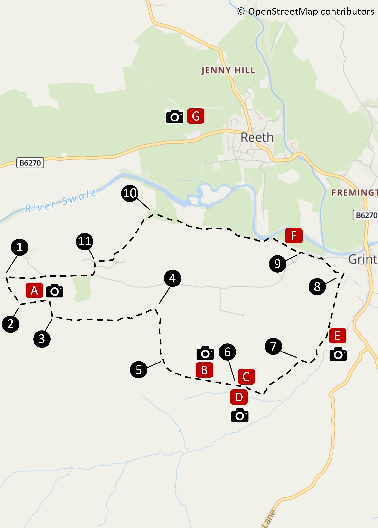
Steps
-
From the parking area, take the footpath and climb on a narrow track leading up to a small tree.
-
At tree, cross the ditch to enter Maiden Castle. Cross Maiden Castle to find the two collapsed sides of its stone entrance avenue,
then walk beside the avenue until the stones run out. Here turn R and head directly up hill over heather (no path) for 150m
to a crossing path where the ground levels out.
-
Turn L. Continue along this clear path for 800m to reach a wall in front of a line of trees. Turn R.
-
Climb on this wide, clear path for 500m until it levels out, then continue a further 60m.
-
Here, strike L across the heather (no path) keeping parallel with the ridge on your L, aiming at the middle of a
large green field on the edge of the moor ahead to reach an embanked stone circle (marked ‘Hut Circle’ on OS maps)
after 300m.
Looking E from the circle, you will see the Grinton to Leyburn road climbing over the moor. Head in this direction
for 200m to find a large, linear earthwork with ditches on either side, bisected by a fence.
-
Pass through the fence using a gate in the northern ditch arriving after 25m at a crossing path.
Turn L, shortly passing through another gate, then continue down hill.
-
At a crossing path, turn R towards a fence, then turn L just before a gate, now with fence on your R.
After 150m the path meanders away from fence towards a gate.
Pass through the gate and continue ahead, shortly with wall to your L. Where the path bears R, continue ahead,
passing through a stile beside a barn. Pass down through another stile then, on reaching a stile in the wall to your R, turn L.
-
This path takes you past a white-washed house to a road via two narrow stiles. Turn L onto road.
(a detour to your R along the road for 350m takes you to Grinton’s pub and graceful Grade I listed church
with its 12th century tower).
-
Where the road turns up hill, join the Swale Trail on your R. After 1km, where a small footbridge veers R
towards the Swing Bridge, pass through the metal gate and continue for 90m.
-
As the Swale Trail swings R, look up half L for a stile and fingerpost. Head through this stile and continue in
the same direction through another wooden stile and a metal gate, then bear R along track.
-
Turn L in farmyard, across a cattle grid then up to the road where turn R back to the start.
Points of Interest
-
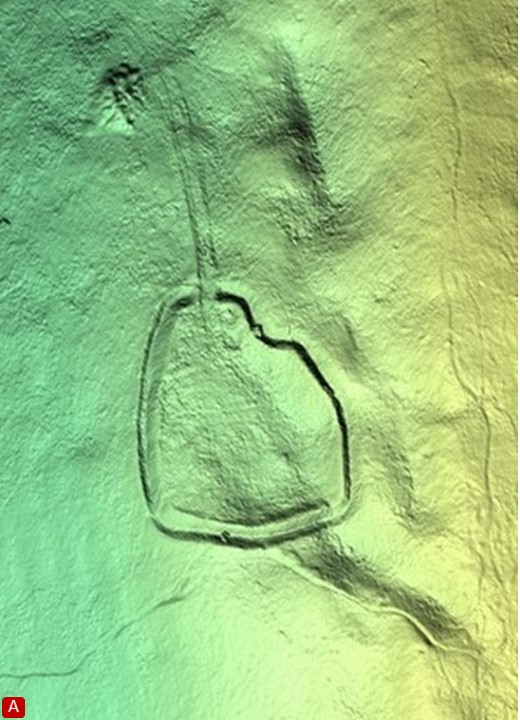
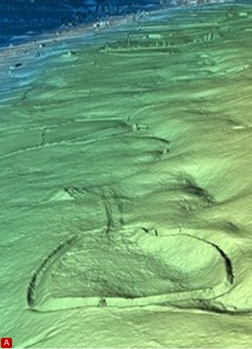
Maiden Castle is an impressive Iron Age enclosure with deep ditches and an unusual stone entrance avenue.
Not considered defensive, its purpose is unknown. The remains of two roundhouses and a stone-lined cist
have been identified within.
-
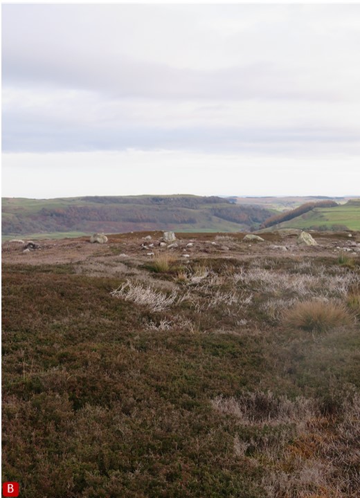
This stone circle, 11m across, sits centrally within a Bronze Age field system. There are 7 upright stones, 30-60cm high.
-
Over 350m in length this substantial earthwork is part of an extensive territorial boundary system.
-
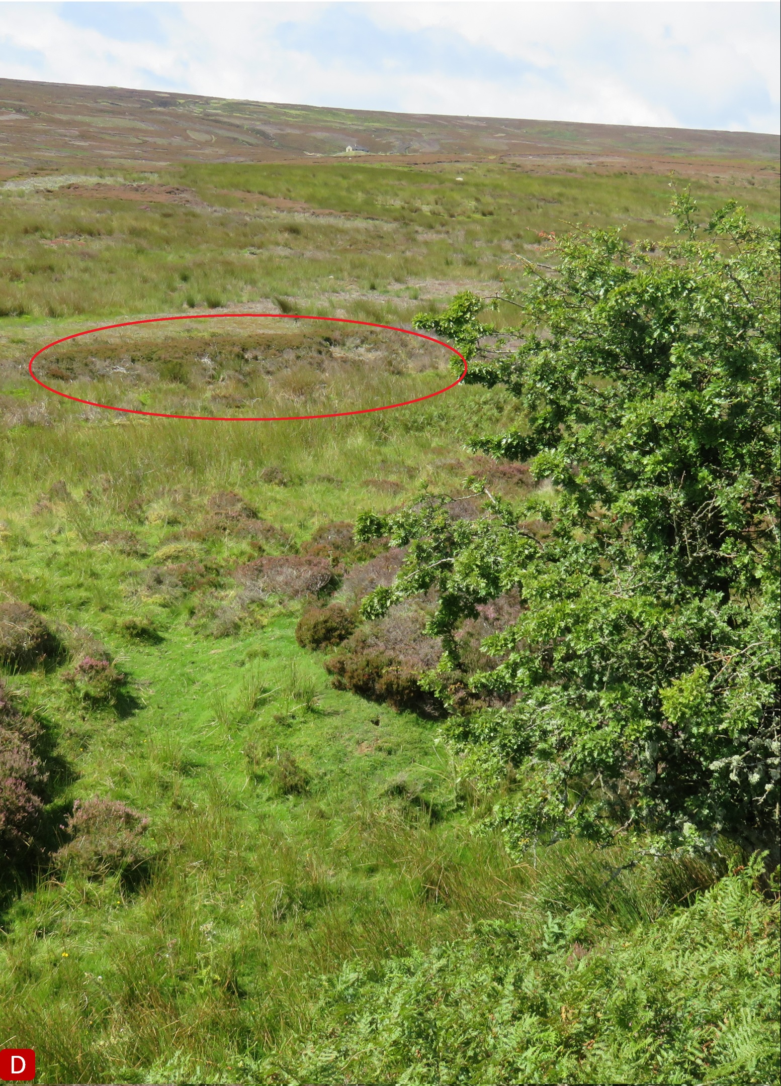
The low slung feature near a solitary hawthorn is a ‘burnt mound’ – one of several in the area. Beneath the heather,
investigations have revealed rocks scorched by repeated heating. Water would have been poured onto the hot rocks
under a canopy creating a Bronze Age steam room or sauna.
-
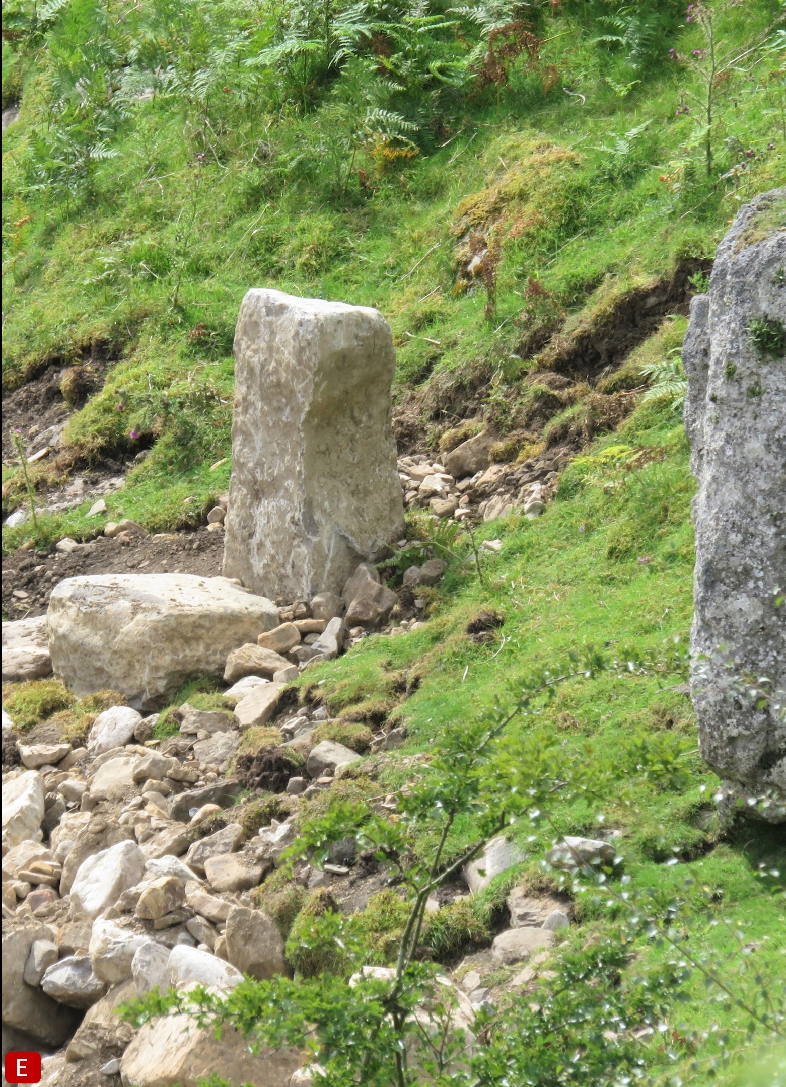
Look over the fence to find a large, square-fronted stone. This is John Moss’s Chair. No-one is certain who John was
but it has been suggested that he was one of several ‘spirits’ known to local folklore.
-
An information post marks the Grinton-Fremington dykes, which include the earthwork at C above. Recent evidence suggests
the system is pre-historic.
-
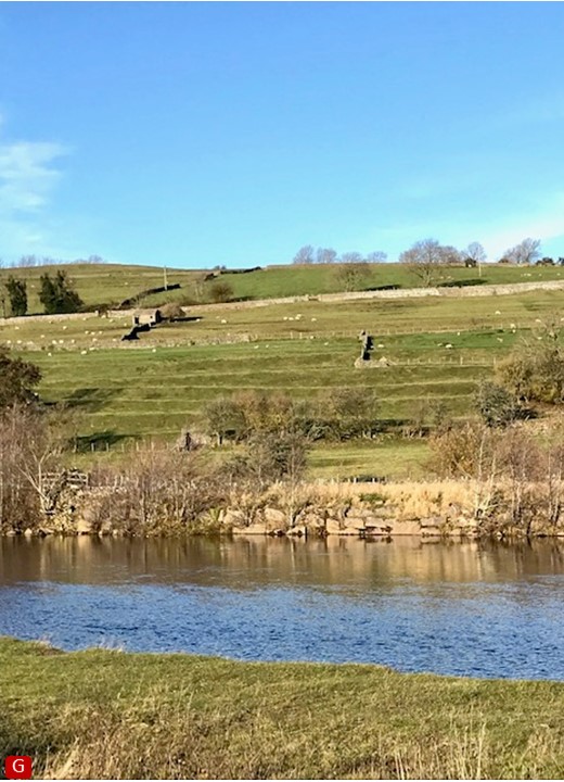
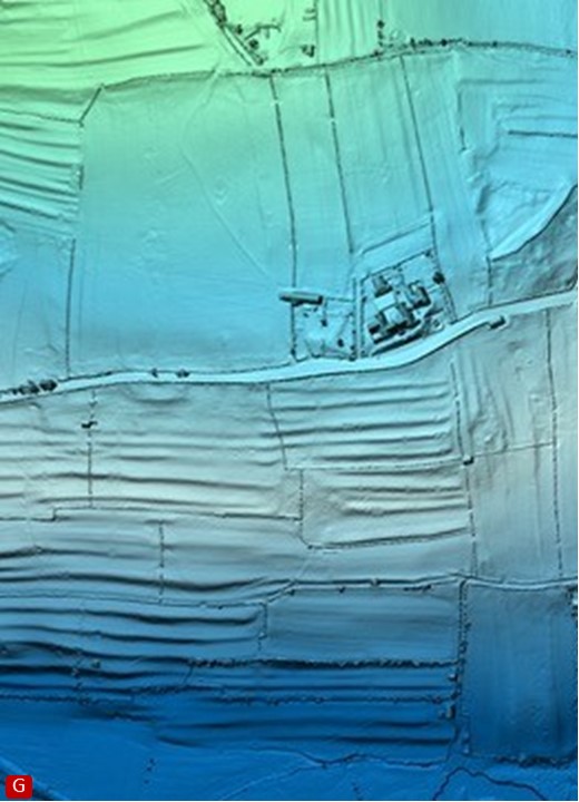
Across the river, terraces in the fields west of Reeth are evidence that arable farming was practiced here in medieval times.
Credits
All Lidar Aerial photos courtesy of Stephen Eastmead. Images have been cropped for presentation.
Further Reading
White, Robert,
The Yorkshire Dales. A Landscape Through Time
, Ilkley, Great Northern Books, 2002 1,3
Fleming, Andrew,
Swaledale. Valley of the Wild River
, Edinburgh, Edinburgh University Press, 1998, and reprint of 1st edition by Windgather Press/Oxbow Books, 2010 1,3
See also
'Out of Oblivion' website (http://www.outofoblivion.org.uk/record.asp?id=342)
based on the Historic Environment Record (HER) maintained by the Yorkshire Dales National Park Authority.
Swaledale and Arkengarthdale Archaeology Group https://swaag.org/publicationsSWAAG03.htm
1: available from Museum bookshop. 2: available via our online shop. 3: available in our Library - contact us to arrange viewing.
|